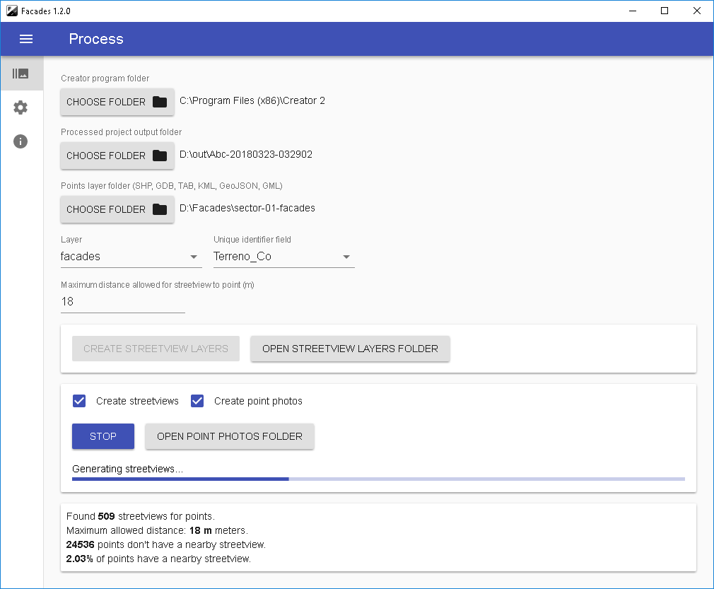
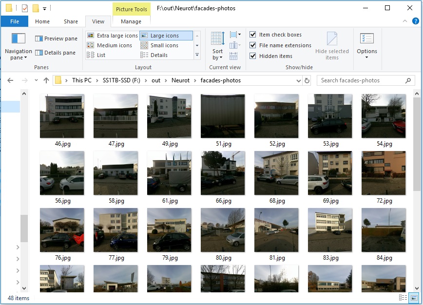
Facades automatically matches Streetviews to building coordinates by Latitude and Longitude. It then creates photos of the building facades. The photos can then be added to your existing GIS system. Or to any documentation. Even printed catalogs.
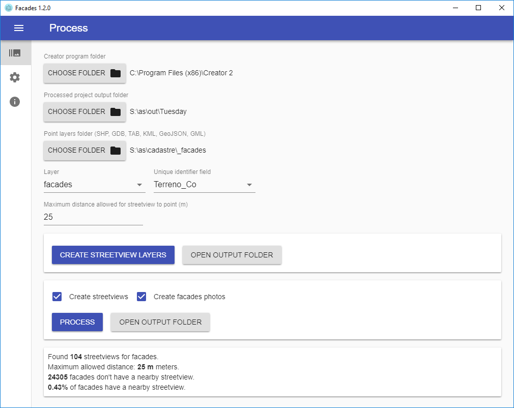
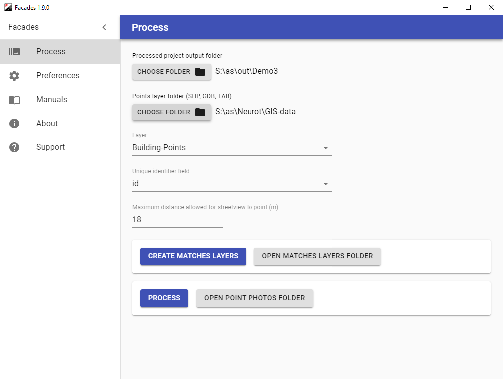
For the building coordinates (latitude/longitude), point layer data in SHP, GDB, TAB, KML, GeoJSON and GML formats are accepted.
Screenshots
Main Features
For mass production
Pick the “unique identifier field” for the photos name
Supports SHP, GDB, TAB, KML, GeoJSON, and GML formats for point layers
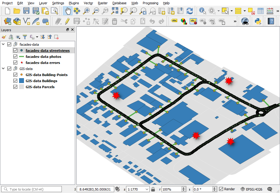
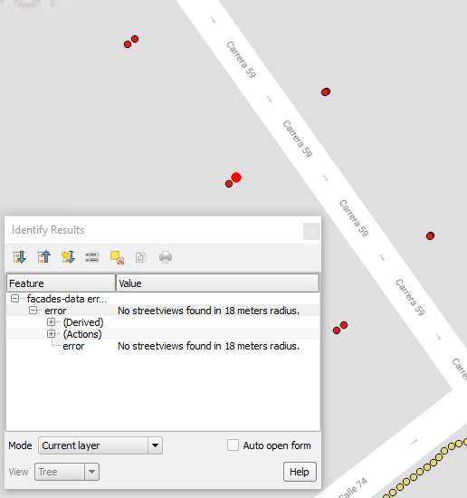
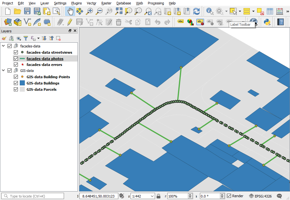
Review in QGIS or ArcGIS
Workflow
Record Streetviews by car with the recording mode set to Distance and 1 meter
With the Creator 5 program, configure the recorded project as usual
Process the project with Creator 5
Facades to load both the point data layer and the Creator 5 project
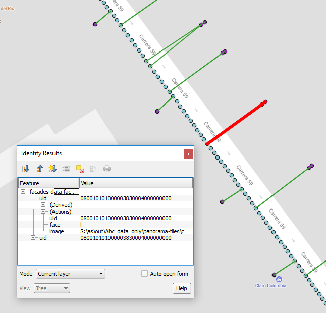
Facades to create the Streetview layer. It has one Streetview for each point
Optional: Review the Streetview layer with QGIS or ArcGIS
Facades to create the buildings photos
Downloads
All our programs are available for evaluation for two weeks. Free of charge.